Welcome, Kapamilya! We use cookies to improve your browsing experience. Continuing to use this site means you agree to our use of cookies. Tell me more!
Why powerful typhoons hit Philippines during 'ber' months
Why powerful typhoons hit Philippines during 'ber' months
Raphael Bosano,
ABS-CBN News
Published Nov 09, 2023 02:20 PM PHT
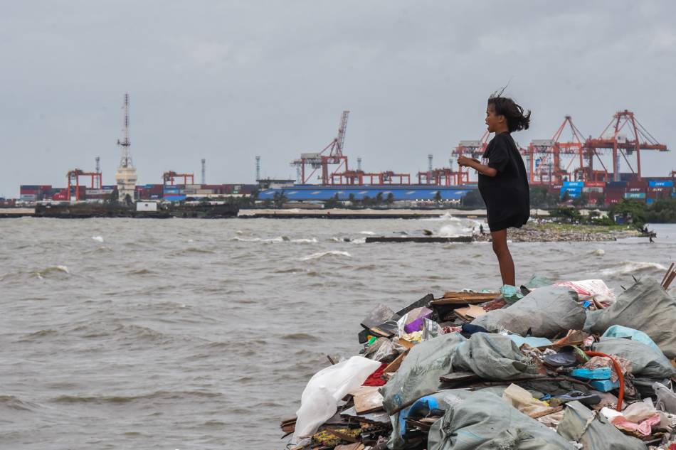
Residents collect garbage as rough waves and strong winds from several weather disturbances continue to affect the country on Sept. 1, 2023. Maria Tan ABS-CBN News
MANILA — A decade since making landfall and claiming thousands of lives, super typhoon Yolanda remains the most powerful cyclone to ever hit the Philippines in recent history.
But the disaster caused by Yolanda was definitely not the first. The years prior to and after the super typhoon saw weather systems of varying intensities causing significant devastation in infrastructure and lives.
Tropical storm Sendong (Washi) brought torrential rains and triggered disastrous flash floods and landslides in Mindanao, making it the deadliest storm in 2011.
A year later, Typhoon Pablo (Bopha), comparable to a category 5 cyclone in the western hemisphere, ravaged the same region.
More recently, the nightmare of Tropical Storm Ondoy (Ketsana) in 2009 that swamped Marikina and other parts of Metro Manila was relived in 2020 when Typhoon Ulysses (Vamco) battered Luzon.
The following year, Typhoon Odette (Rai) wreaked havoc in Mindanao and Visayas.
While these extreme weather events all happened in different years within a span of over a decade, they all have one thing in common – they all occurred in the last quarter of the year or, as Filipinos call it, the "ber" months.
For state weather bureau PAGASA, the occurrence of stronger storms during this time of the year no longer comes as a surprise.
PAGASA weather specialist Benison Estareja said at least two factors affect the formation of stronger storms and the path they take, namely, warmer sea surface temperature in the central Pacific Ocean and high pressure.
"'Yung mainit na sea surface temperature, isa yan sa mga factor kung bakit may nabubuo na mga cloud clusters na eventually po ay nagiging bagyo. Dahil sa high pressure area during ‘ber’ months, mas napu-push pababa yung direksyon ng mga bagyo so either westward or west northwest towards Mindanao, Visayas and Central Luzon," he said.
(The warmer sea surface temperature is one factor why cloud clusters form which eventually develop into a storm. The high-pressure area during ‘ber’ months pushes these storms further down, so either westward or west-northwest towards Mindanao, Visayas, and Central Luzon.)
It also doesn’t help that an El Niño phenomenon is in effect. While El Niño reduces the likelihood of below-normal rainfall in some parts of the country, above-normal rainfall conditions can still occur in others.
And because El Niño is characterized by a rise in sea surface temperature, it can most definitely cause cloud formations in the Pacific that can form into a potentially stronger typhoon.
"Definitely makaka-contribute yan sa pagkakaroon ng malalakas na bagyo. Then napagbasehan na rin ito sa mga previous studies na generally, pag merong El Niño, mas marami yung bilang ng malalakas na bagyo, even though yung bilang overall ng bagyo ay kakaunti ng bahagya," the forecaster said.
(It definitely contributes to the occurrence of stronger typhoons. It has also been seen in previous studies that, generally, during El Niño there is the occurrence of stronger typhoons even though their number overall is slightly fewer.)
This finding is in line with the Intergovernmental Panel on Climate Change’s (IPCC) report that weather events, while they may not increase in numbers, may become more intense, especially with climate change.
Estareja added that while it would take years for the public to feel the strong effects of climate change, the fact that El Niño is happening now along with the degradation of the environment, more extreme climate events are likely to happen compared to previous decades.
“Yung return period kasi ng Yolanda, yung over 220km na nagla-landfall, is every 200 years. Pero posibleng magkaroon pa rin ng mala-Yolandang bagyo pero either didikit lang siya or hindi siya magla-landfall,” Estareja said.
(The return period of Yolanda, those with maximum winds of over 220 kilometers per hour and make landfall, happens every 200 years. But it is still possible to monitor Yolanda-like super typhoons which will either only get close to land or not make landfall at all.)
Still, the country remains highly vulnerable to extreme weather events.
However, despite the lessons learned following Yolanda, environment group Kalikasan said it seemed the country had a long way to go towards the path of preparedness and resilience.
“Wala pa rin talagang clear action points. There have been some laws that have been passed. Pero ever since we’ve seen Yolanda, may mga typhoons pa rin that are coming in an are still devastating yung mga communities,” said Kalikasan National Coordinator, Jon Bonifacio.
(For us in Kalikasan, it seems there are still no clear action points. There have been some laws that have been passed. But ever since Yolanda, there are still typhoons that come in and are still devastating the communities.)
“Gusto naman natin dito ay magkaroon ng concrete steps towards climate adaptation, proper solutions sa mga hinaharap na challenges related to climate change pati na rin yung usapin ng mitigation o pagbabawas ng greenhouse gas emissions,” he added.
(We want to see concrete steps towards climate adaptation, proper solutions in the future related to climate change as well as mitigation or reduction of greenhouse gas emissions.)
With two more months left in 2023, PAGASA said it was expecting at least two to three typhoons to enter the Philippine area of responsibility.
It remains unknown if the remaining typhoons this year will be as intense as those that came before it.
Disaster officials are banking on the lessons learned by communities following the onslaught of the deadliest and costliest typhoons in the country so that destruction will be reduced and, more importantly, deaths prevented.
ABS-CBN is the leading media and entertainment company in the Philippines, offering quality content across TV, radio, digital, and film. Committed to public service and promoting Filipino values, ABS-CBN continues to inspire and connect audiences worldwide.
Our website is made possible by displaying online
advertisements to our visitors. Please consider supporting
us by disabling your ad blocker on our website.
Our website is made possible by displaying online
advertisements to our visitors. Please consider supporting
us by disabling your ad blocker on our website.