Welcome, Kapamilya! We use cookies to improve your browsing experience. Continuing to use this site means you agree to our use of cookies. Tell me more!
PAGASA monitoring potential 'super typhoon' outside PAR
PAGASA monitoring potential 'super typhoon' outside PAR
ABS-CBN News
Published May 22, 2023 07:25 AM PHT
|
Updated May 22, 2023 07:26 AM PHT
Watch more on iWantTFC.com. Watch hundreds of Pinoy shows, movies, live sports and news.
Watch more on iWantTFC.com. Watch hundreds of Pinoy shows, movies, live sports and news.
MANILA -- State weather bureau PAGASA on Monday said it is monitoring a tropical cyclone that may develop into a super typhoon outside the Philippine area of responsibility (PAR).
In its latest public weather forecast, PAGASA said the cyclone was last seen 2,330 km east of Mindanao.
It has maximum sustained winds of 130 kph near the center and gusts of up to 160 kph. It is moving west northweatward at 15 kph.
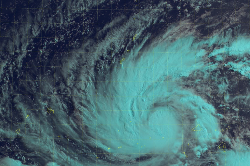
Himawari-8 Imagery of Typhoon Mawar near Guam. Imagery courtesy of the Japanese Meteorological Agency
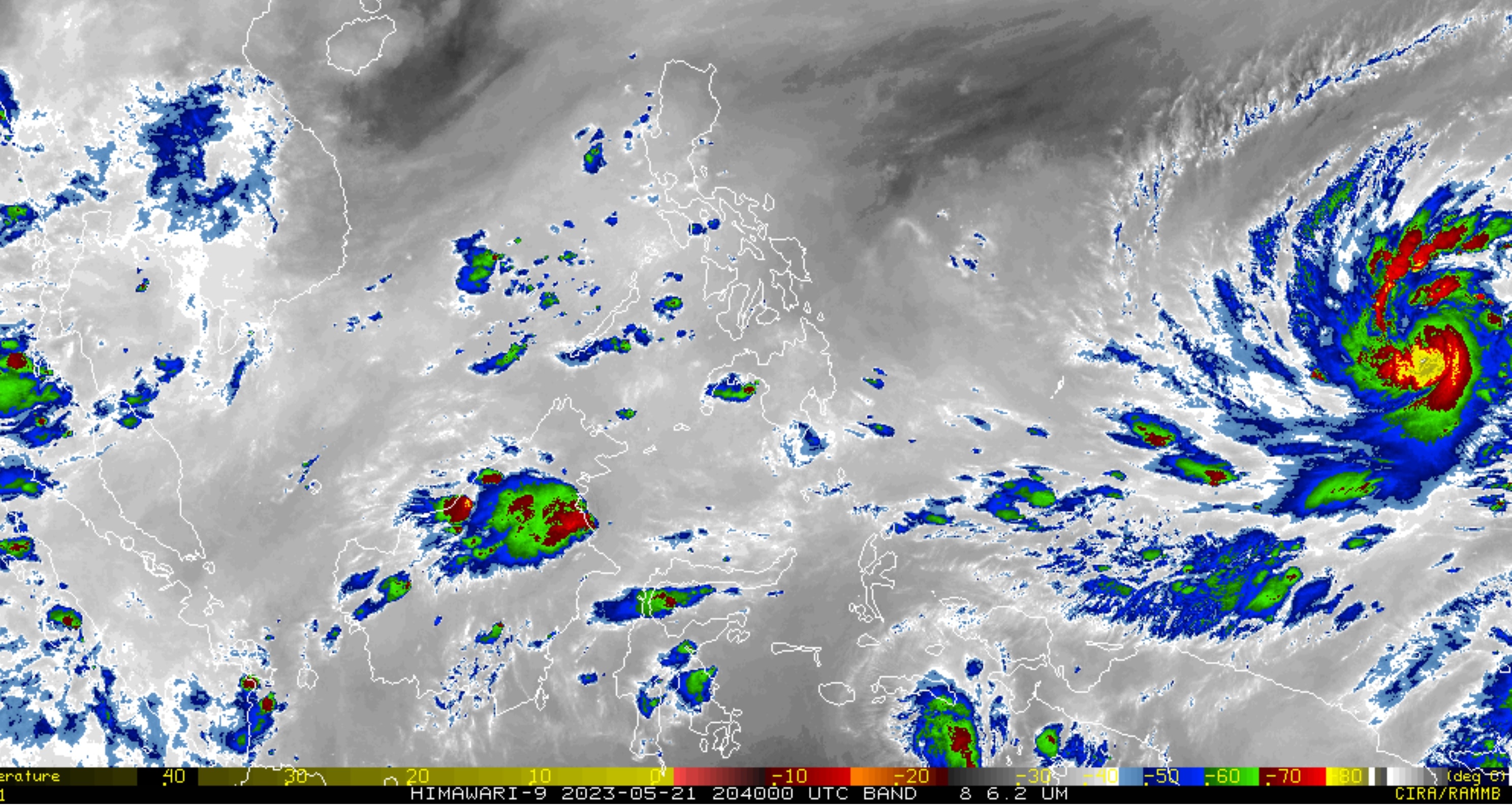
Himawari-8 Imagery of Typhoon Mawar near Philippines. Imagery courtesy of the Japanese Meteorological Agency
Weather forecaster Anna Clauren-Jorda said there is a low probability of the cyclone making landfall in the Philippines.
ADVERTISEMENT
"In the next 24 to 48 hours makikita natin na possible po itong umabot sa kategorya na super typhoon, pero hindi po naman po natin nakikita na magkakaroon po ito ng landfall scenario sa anumang bahagi ng ating bansa," she said.
"Pero pinag-iingat at pinaghahanda pa rin natin yung ating mga kababayan dahil possible nga po itong mag-enhance o magpalakas ng southwest monsoon o habagat na kung saan magpapaulan sa may kanlurang bahagi ng ating bansa," she added.
Meanwhile, a southwesterly wind flow is affecting the western sections of southern Luzon, Visayas, and Mindanao.
Cloudy skies with scattered rainshowers and thunderstorms are expected over Palawan, Occidental Mindoro, and Antique.
Meanwhile, Metro Manila and the rest of the country will have partly cloudy to cloudy skies with isolated rainshowers or thunderstorms due to the southwesterly windflow and localized thunderstorms.
ABS-CBN is the leading media and entertainment company in the Philippines, offering quality content across TV, radio, digital, and film. Committed to public service and promoting Filipino values, ABS-CBN continues to inspire and connect audiences worldwide.
Our website is made possible by displaying online
advertisements to our visitors. Please consider supporting
us by disabling your ad blocker on our website.
Our website is made possible by displaying online
advertisements to our visitors. Please consider supporting
us by disabling your ad blocker on our website.