Welcome, Kapamilya! We use cookies to improve your browsing experience. Continuing to use this site means you agree to our use of cookies. Tell me more!
MANILA - Typhoon Odette hit the Philippines last week, ravaging Visayas and Mindanao with heavy rains and gale-force winds. Hundreds of thousands of families were affected, with some forced to evacuate from homes that were destroyed by the typhoon. All before Christmas.
According to the National Risk Reduction and Management Council's December 23, 2021 situational report on Odette, at least 258 people were killed due to the typhoon, while 47 were missing.
It was no surprise that on Twitter, some people lamented the government’s defunding of what University of the Philippines President Danilo L. Concepcion called in 2017 “a lifesaver for millions of Filipinos threatened by natural disasters like floods, landslides, and storm surges.”
With the outcome of Odette’s fury, I wish the government will house the homeless in a tenement housing built based on Building Codes and Project Noah - planned by an urban planner. This can surely reduce the risks during a disaster threat. May God Bless us all.
Not Shar related. Pero masaya aq at okay ng friend q sa Iloilo. May kuryente na cla. Kung hindi sana iniStop ang project noah at bingyan ng budget for calamity edi sana mas mabilis ang pagusad ng mga nasalanta. Hindi sapat ang pagsabi mo na sorry at wala budget pra sa nasalanta.
The defunded program was “Project NOAH”, a program put up by the Department of Science and Technology during the administration of late former President Benigno “Noynoy” Aquino. Under it were research projects which would help the government warn communities of hazards like flooding and landslides up to six hours in advance.
ADVERTISEMENT
During its lifetime under government funding from 2012 to 2017, Project NOAH won multiple awards both at home and abroad. It also brought Filipinos mobile apps through which they could receive real-time weather updates, satellite images of any typhoons in the country’s area of responsibility, and maps of areas at risk from flooding and landslides.
This is not the first time Filipinos criticized the Duterte administration for defunding the project, or accused it of not prioritizing Disaster Risk Reduction and Management. This is also not the first time people called for it to be revived.
Though, as its Executive Director Dr. Mahar Lagmay noted, people only looked for it after something had already happened.
“That’s sad,” he said during his interview with ABS-CBN News. “We saw this in advance.”
Even after all of its research outputs had been transferred to other government agencies, even after four-fifths of the people who worked under it have moved on to other pastures, Project NOAH is still sought after more than four years after it was defunded. One can’t help but wonder, what was so special about it? Is it still around? And what has both its proponents and the government done after the proverbial ark sailed?
Project NOAH
In December 2011, Tropical Storm “Sendong” (Washi) dealt catastrophic damage to Mindanao before Christmas. More than 1,200 people were dead and around 180 were missing across 13 provinces, with more than P1 billion worth of damage. The continuous rainfall Sendong brought to the region triggered disastrous flash floods.
It was in the wake of Sendong that the Aquino administration’s DOST under then-Secretary Mario Montejo established Project NOAH or the Nationwide Operational Assessment of Hazards in 2012. National Institute of Geological Sciences professor Dr. Mahar Lagmay was picked as the program’s Executive Director for his expertise in disaster mitigation. While announcing the program in Marikina, Aquino called it an “ark” for Filipinos against disasters.
The program started with these initial research projects:
Hydromet sensors development, or the distribution of automated rain gauges and water level monitoring stations throughout the country.
Disaster Risk Exposure Assessment for Mitigation - Light Detection and Ranging (DREAM-LIDAR), which aimed to produce more accurate hazard maps.
Enhancing Geohazards Mapping through LIDAR, or the use of LIDAR technology to identify areas prone to landslides.
Coastal Hazards and Storm Surge Assessment and Mitigation (CHASSAM), or the generation of models to recommend solutions for coastal erosion.
Flood Information Network (FloodNET), an upgraded way of delivering flood information for early warning systems.
Local Development of Doppler Radar Systems (LaDDeRS), which aimed to develop the local capacity to make subsystems for advanced Doppler radars.
Landslide Sensors Development Project, or the creation of a low-cost, locally-developed sensor-based early monitoring and warning system for landslides.
Weather Hazard Information Project (WHIP), the dissemination of weather data through television and the internet in real-time to help communities prepare against hazards.
The initial goal was to help warn communities of potential hazards in advance, giving them crucial time to prepare for a coming storm or evacuate their homes. The program eventually grew to cover 20 research and development projects in total.
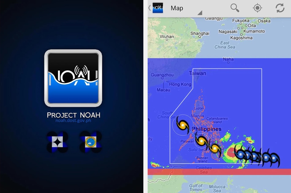
Under NOAH, two mobile phone apps were developed. The first was "Project NOAH", which provided real-time weather monitoring tools like satellite and Doppler radar data and weather forecast information from the NOAH website. The other app was "Arko", which gave users hazard maps of areas prone to floods, storm surges, and landslides.
The "Project NOAH" mobile app, which promised users real-time weather information which could prevent and mitigate disasters. UP NOAH app page on Google Play Store.
In 2017, the project was officially defunded due to lack of funds. Science and Technology Secretary Fortunato Dela Peña told ABS-CBN's TeleRadyo that year that the project was supposed to have ended in 2015, but was extended.
The technologies developed through projects under NOAH were turned over to state weather bureau PAGASA, the state seismology bureau PHIVOLCS, the National Mapping and Resource Information Authority, and the Mines and Geosciences Bureau. The idea was for the agencies to continue using these technologies for weather forecasting, disaster mitigation, and the making of hazard maps.
Before NOAH's government funding was cut, it was adopted by the University of the Philippines. In June 2017, UP launched its Resilience Institute with the UP NOAH Center. Dr. Mahar Lagmay was picked as UPRI's Executive Director.
Project NOAH's mobile applications meanwhile remained available on app stores. But the Android version of the app hasn't received an update since 2017, with multiple users reporting errors while using it.
For the Department of Science and Technology, Project NOAH was a collection of research projects, all of which were completed, with the outputs turned over to the concerned agencies.
PHIVOLCS Director and DOST Undersecretary for Disaster Risk Reduction and Climate Change Adaptation Renato Solidum told ABS-CBN News that DOST had also developed other mobile and web applications which could warn both residents and local governments of disaster hazards.
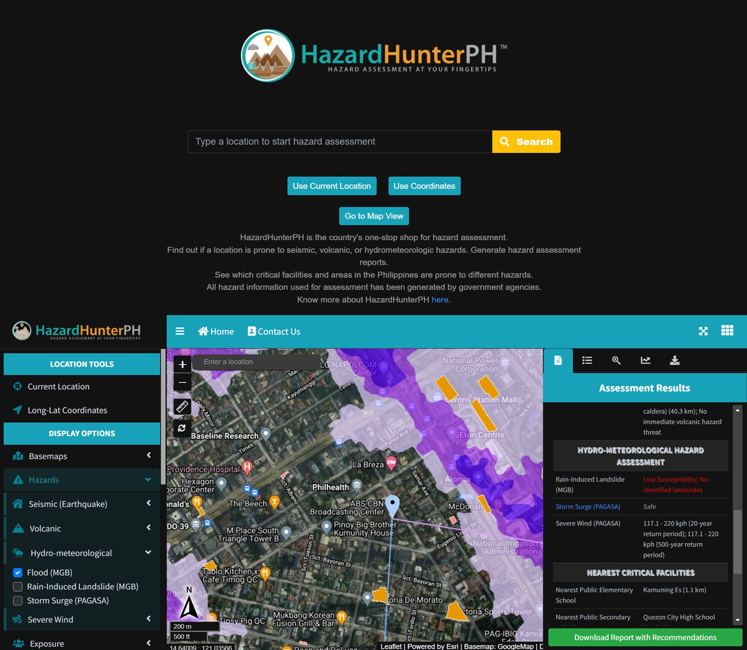
Hazard Hunter PH promises to be a "one-stop shop for hazard assessment." It shows users whether an area is at risk from earthquakes, volcanic eruptions, floods and other potential hazards. Screenshots from website.
One such application is Hazard Hunter PH, which promises to be a "one-stop shop for hazard assessment" that shows users if an area is prone to seismic, volcanic, or hydro-meteorological hazards. Meaning, it features flood and landslide hazard maps with the addition of seismic, volcanic, and hydro-meteorological risk assessments.
Solidum added that even though Project NOAH had been defunded, research and development projects for disaster risk reduction and management in the country did not stop.
He said many projects were currently being worked on under Section V of the country's Harmonized National Research and Development Agenda or HNRDA. This means that disaster risk reduction and management R&D is being done under a certain direction.
Under Section V or "Disaster Risk Reduction and Climate Change Adaptation Research and Development Agenda", the following priorities are listed:
THEME I - Monitoring and Forecasting A. Observation and Monitoring Networks B. Technology Development and Application for Monitoring C. Modelling and Simulation for Improvement of Monitoring and Forecasting
THEME II - Hazard and Risk Assessment D. Hazards, Vulnerability and Risk Assessment
THEME III - Warning E. Warning and Risk Communication
THEME IV - Proper and Timely Response F. Technology Development and Application for Climate Change Mitigation and Adaptation G. Technology Development and Application for Disaster Risk Management H. Policy Research
Solidum added that it was important to use science and technology to address current disaster risks and long-term risks caused by climate change.
“All of these strategic concerns are being addressed by various DOST agencies and, more importantly, research partners both in the academe and in other organizations,” he said.
PAGASA was one of the recipients of Project NOAH's outputs. The agency's administrator, Dr. Vicente Malano, told ABS-CBN News in a text message that PAGASA was working on a project "closely related to NOAH," with Deputy Administrator for Operations & Services Dr. Landrico Dalida in charge. As of writing, Dr. Dalida has yet to reply to requests for interview on the matter.
When asked if the Department of Science and Technology had any plans to carry out another program like Project NOAH in the future, Secretary Fortunato Dela Peña said PAGASA was "continuously developing models that will improve their delivery of services."
"PAGASA has a very small average forecast error in their typhoon forecast compared to the target forecast error of the World Meteorological Organization," he said in a text message to ABS-CBN News.
For UP NOAH’s Executive Director Mahar Lagmay, though, NOAH was more than the research outputs transferred to agencies after its defunding. The bigger losses were human capital, and an opportunity to show Filipinos that science benefited society.
Out of the roughly 200 original members of Project NOAH, Lagmay said around 30 to 40 were retained in its current incarnation as UP NOAH. Though it again has more than 200 people on board, Lagmay said more could have been done for the original members.
“We could have sent them abroad to learn more, di ba?” he said. “Sustain their interest in science, sustain, kasi these were young researchers no? Mold them so we'll have a next generation of practitioners. Scientists na disaster practitioners.”
(These were young researchers no? Mold them so we'll have a next generation of practitioners. Scientists that are also disaster practitioners.)
Lagmay added that Project NOAH had impetus, and accumulating skilled experts was necessary to tackle what he described as a mountain of problems when it came to disaster risk reduction and management.
"Disasters are the best example for the next generation for people to learn for education purposes, di ba? That will inspire them. It will get them to realize that science is important,” he said.
When asked if Project NOAH could have helped avert casualties during Typhoon Odette, Lagmay said it could have provided the NDRRMC with data that could help it provide hazard-specific, area-focused, and time-bound hazard warnings to communities.
The UPRI Head however noted that the transfer of technology produced by Project NOAH to government agencies was successful. He said one of the resulting improvements was with government flood and landslide hazard maps.
UP NOAH
In its current form as UP NOAH, the group aims to raise Filipinos' awareness of disasters. According to the UP NOAH website, it has been geared to undertake “advanced disaster research and comprehensive and multidisciplinary assessment of hazards. The results of which are developed into accessible tools that are relevant for local government units, community leaders, policy makers, planners, and families to prevent and mitigate disasters.”
Lagmay said that UP NOAH is working on around 20 projects, the biggest of which is a P750-M project to help several cities in Luzon, Visayas, and Mindanao make climate action and disaster risk reduction management plans. UP NOAH is working with up to four other groups in the effort, which is funded by a grant from USAID.
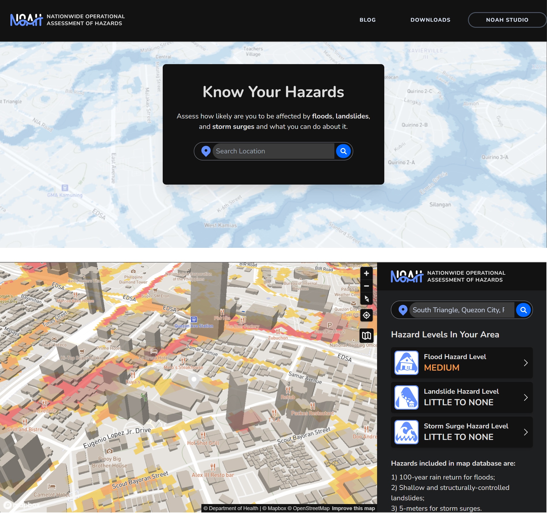
A new UP NOAH website has also been launched, where Filipinos can enter their location and see its risk for flood and landslides, similar to Hazard Hunter PH.
UP NOAH's website, which offers flood, landslide, and storm surge risk assessments to users. The more advanced "NOAH Studio" offers features such as Weather Satellite Imaging. Screenshots from website.
“The work for disasters will never end because disasters unfold in different ways. And we only learn the lessons once they have unfolded. So there will always be something new that we have to look into that, study them, and create solutions for them, and record them as well because we do not want to repeat the same mistakes,” Lagmay said.
“As long as we keep on repeating the same mistakes, we will never solve our disaster problems.”
PURPOSE
On one hand, for the government, Project NOAH had served its purpose as a research program whose outputs had been distributed to agencies who would need them. Research and Development into disaster risk reduction has not stopped either, and continues under a defined direction.
On the other hand, for NOAH itself, it found a new home in UP and is pursuing its own R&D projects for disaster risk reduction and management.
It appears both sides have more or less moved on from the "ark" that was Project NOAH.
Though the question remains about whether or not Filipinos have gotten closer to the "Mount Ararat" of fewer casualties from natural disasters.
ABS-CBN is the leading media and entertainment company in the Philippines, offering quality content across TV, radio, digital, and film. Committed to public service and promoting Filipino values, ABS-CBN continues to inspire and connect audiences worldwide.
Our website is made possible by displaying online
advertisements to our visitors. Please consider supporting
us by disabling your ad blocker on our website.
Our website is made possible by displaying online
advertisements to our visitors. Please consider supporting
us by disabling your ad blocker on our website.