'Julian' strengthens into a typhoon, remains far from PH landmass | ABS-CBN


ADVERTISEMENT

Welcome, Kapamilya! We use cookies to improve your browsing experience. Continuing to use this site means you agree to our use of cookies. Tell me more!
'Julian' strengthens into a typhoon, remains far from PH landmass
'Julian' strengthens into a typhoon, remains far from PH landmass
ABS-CBN News
Published Aug 30, 2020 07:29 AM PHT
|
Updated Aug 30, 2020 02:35 PM PHT
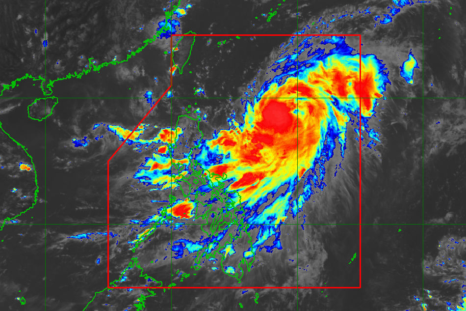
MANILA (UPDATE) - Severe tropical storm Julian has intensified into a typhoon early Sunday although it remained far from Philippine landmass, the state weather bureau said.
MANILA (UPDATE) - Severe tropical storm Julian has intensified into a typhoon early Sunday although it remained far from Philippine landmass, the state weather bureau said.
The typhoon was last spotted 760 kilometers east of Tuguegarao City, Cagayan, moving almost stationary and packing maximum winds of 140 km per hour and gusts of up to 170 kph as of 10 a.m., PAGASA said in its latest bulletin.
The typhoon was last spotted 760 kilometers east of Tuguegarao City, Cagayan, moving almost stationary and packing maximum winds of 140 km per hour and gusts of up to 170 kph as of 10 a.m., PAGASA said in its latest bulletin.
"Julian" is less likely to directly cause high impact weather over the country, but its outer rainbands may bring light to moderate rains over Bicol region, with at times heavy rains over Catanduanes, according to PAGASA.
"Julian" is less likely to directly cause high impact weather over the country, but its outer rainbands may bring light to moderate rains over Bicol region, with at times heavy rains over Catanduanes, according to PAGASA.
Moderate to at times heavy monsoon rains will prevail over Pangasinan, Zambales, and Bataan, it added.
Moderate to at times heavy monsoon rains will prevail over Pangasinan, Zambales, and Bataan, it added.
ADVERTISEMENT
Those with small boats are advised to take precautionary measures while venturing out to sea as moderate to rough seas (2.1 to 3.4 m) will be experienced over the seaboards of Northern Luzon and the eastern seaboards of Central Luzon, Southern Luzon, and Visayas due to Julian and the southwest monsoon.
Those with small boats are advised to take precautionary measures while venturing out to sea as moderate to rough seas (2.1 to 3.4 m) will be experienced over the seaboards of Northern Luzon and the eastern seaboards of Central Luzon, Southern Luzon, and Visayas due to Julian and the southwest monsoon.
The typhoon is expected to exit the Philippine area of responsibility (PAR) between Monday evening and early Tuesday.
The typhoon is expected to exit the Philippine area of responsibility (PAR) between Monday evening and early Tuesday.
Visit the ABS-CBN Weather Center for updates.
Visit the ABS-CBN Weather Center for updates.
ADVERTISEMENT
ADVERTISEMENT