Welcome, Kapamilya! We use cookies to improve your browsing experience. Continuing to use this site means you agree to our use of cookies. Tell me more!
More rain expected as storm Florita moves over West PH Sea
More rain expected as storm Florita moves over West PH Sea
ABS-CBN News
Published Aug 24, 2022 12:37 AM PHT
|
Updated Aug 24, 2022 10:32 AM PHT
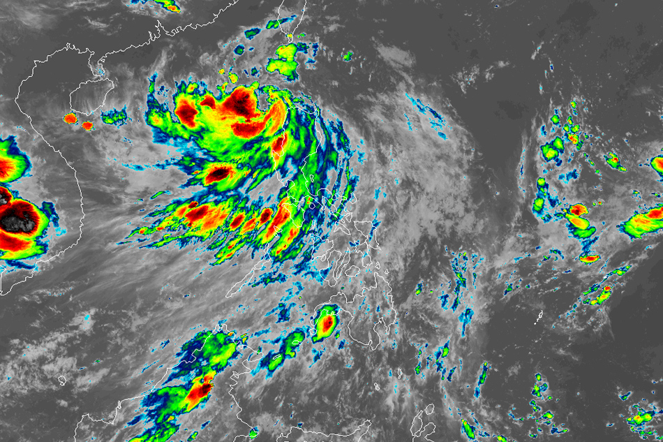
Himawari-8
MANILA — Severe tropical storm Florita weakened further Tuesday night as it moves over the West Philippine Sea, state weather bureau PAGASA said.
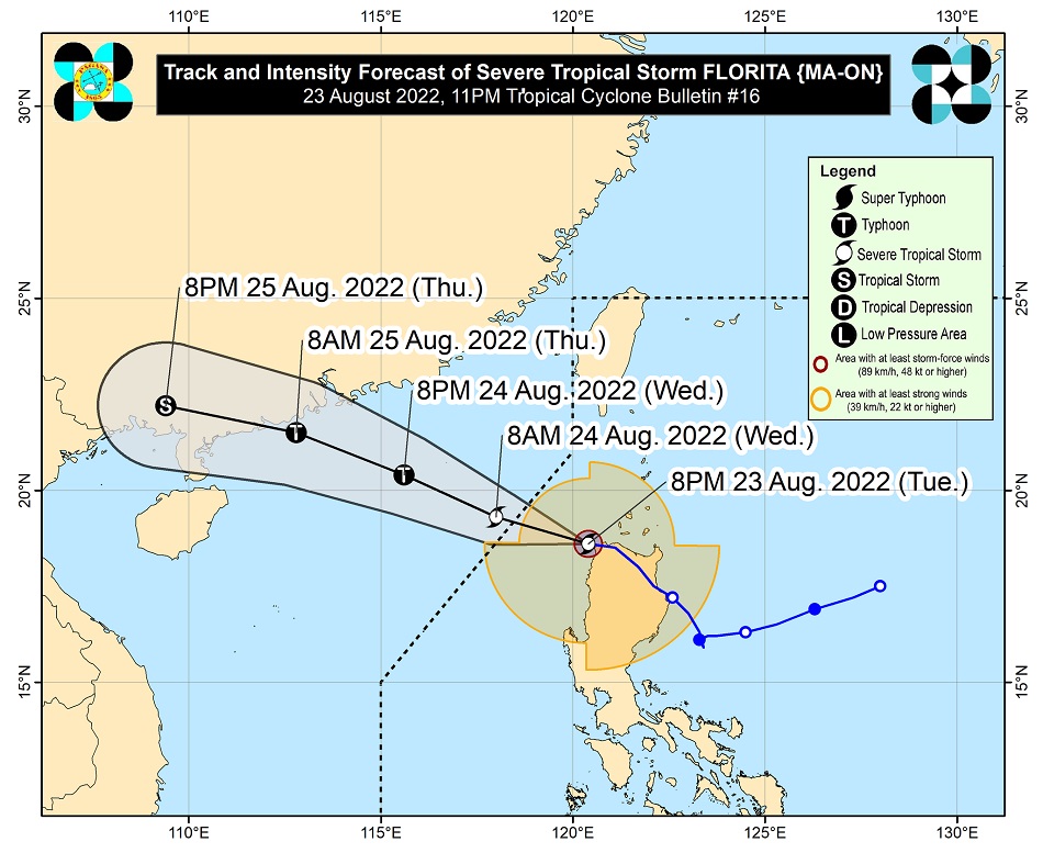
Florita was last spotted 80 kilometers northwest of Laoag City, Ilocos Norte, packing maximum sustained winds of 95 kilometers near the center and up to 115 kph gusts, PAGASA said in its 11 p.m. bulletin.
The weather agency said heavy to intense rains may be experienced over Ilocos Region, Abra and Benguet, while Cordillera Administrative Region may experience moderate to heavy with at times intense rains until Wednesday morning. Light to moderate with at times heavy rain may also prevail over Cagayan Valley.
Ilocos Region, on the other hand, may experience light to moderate with at times heavy rains from Wednesday morning through afternoon.
ADVERTISEMENT
Floods and landslides are possible, it warned.
PAGASA raised tropical cyclone warning signal no. 3 in the following areas, where 121 to 170 kph winds could damage nipa and cogon houses, knock down power and communication, and uproot trees:
Northwestern portion of Ilocos Norte (Bacarra, Pasuquin, Burgos, Bangui)
Storm signal 2 was hoisted over the following areas, where 61 to 120 kph winds may be expected in at least 24 hours, said PAGASA.
Northwestern portion of mainland Cagayan (Ballesteros, Abulug, Pamplona, Sanchez-Mira, Claveria, Santa Praxedes)
Western portion of Babuyan Islands (Calayan Is., Dalupiri Is., Fuga Is.)
Apayao
Northern portion of Abra (Tineg, Lacub, Lagayan, San Juan, Lagangilang, Dolores, Tayum, La Paz, Danglas, Bangued, Langiden, Pidigan, San Quintin, San Isidro, Peñarrubia)
Rest of Ilocos Norte
Northern portion of Ilocos Sur (Santa, Caoayan, City of Vigan, Santa Catalina, Santo Domingo, San Vicente, San Ildefonso, Bantay, Magsingal, San Juan, Cabugao, Sinait, Narvacan, Nagbukel, Santa Maria, San Esteban)
PAGASA said storm signal 1 is in effect in the following areas.
Batanes
Rest of Babuyan Islands
Rest of mainland Cagayan
Northern and western portions of Isabela (Cordon, Ramon, San Mateo, Cabatuan, Aurora, San Manuel, Burgos, Quirino, Delfin Albano, Cabagan, Tumauini, San Pablo, Santa Maria, Santo Tomas, Quezon, Mallig, Roxas, Maconacon)
Northern portion of Nueva Vizcaya (Kayapa, Ambaguio, Villaverde, Solano, Bagabag, Diadi)
Rest of Abra
Mountain Province
Ifugao
Benguet
Rest of Ilocos Sur
La Union
In the next 24 hours, PAGASA said the southwest monsoon or habagat will bring moderate to heavy rains over Zambales, Bataan, Occidental Mindoro and Oriental Mindoro, while light to moderate with at times heavy rains will be experienced over the rest of central Luzon, Metro Manila and Calabarzon.
Forecast track of Florita. PAGASA
Florita on Tuesday spawned flooding in several areas, forced the suspension of some classes and government work, and prompted evacuations.
ABS-CBN is the leading media and entertainment company in the Philippines, offering quality content across TV, radio, digital, and film. Committed to public service and promoting Filipino values, ABS-CBN continues to inspire and connect audiences worldwide.
Our website is made possible by displaying online
advertisements to our visitors. Please consider supporting
us by disabling your ad blocker on our website.
Our website is made possible by displaying online
advertisements to our visitors. Please consider supporting
us by disabling your ad blocker on our website.