Welcome, Kapamilya! We use cookies to improve your browsing experience. Continuing to use this site means you agree to our use of cookies. Tell me more!
Florita 'slightly weakens' but storm signals still up: PAGASA
Florita 'slightly weakens' but storm signals still up: PAGASA
ABS-CBN News
Published Aug 23, 2022 06:12 PM PHT
|
Updated Aug 24, 2022 12:39 AM PHT
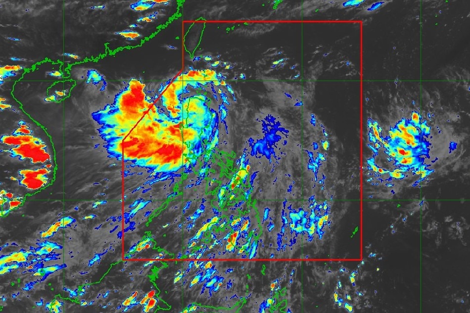
This PAGASA image shows the location of severe tropical storm Florita at 4:30 p.m. Tuesday
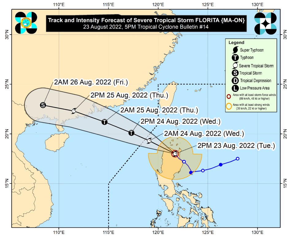
MANILA — Severe tropical storm Florita slightly weakened on Tuesday afternoon, state weather bureau PAGASA said as it retained tropical cyclone warning signals in dozens of areas.
Florita was in the vicinity of Kabugao, Apayao, packing maximum sustained winds of 100 kilometers near the center and up to 125 kph gusts, PAGASA said in its 5 p.m. bulletin.
The weather agency said heavy to intense with at times torrential rains would be experienced Tuesday over Cagayan including Babuyan Islands, Cordillera Administrative Region, Ilocos Region, Zambales, and Bataan.
Expect moderate to heavy rains over Metro Manila, Isabela, Tarlac, Pampanga, Cavite, and the rest of Cagayan Valley, and light to moderate with at times heavy rains over rest of Central Luzon and Calabarzon, PAGASA added.
ADVERTISEMENT
Floods and landslides are possible under these conditions, it warned.
PAGASA raised tropical cyclone warning signal no. 3 in the following areas, where 121 to 170 kph winds could damage nipa and cogon houses, knock down power and communication, and uproot trees:
Storm signal 2 was hoisted over the following areas, where 61 to 120 kph winds may be expected in at least 24 hours, said PAGASA.
Ifugao
Mountain Province
Kalinga
Abra
Ilocos Sur
Rest of Babuyan Islands
PAGASA said storm signal 1 is in effect in the following areas.
La Union
Eastern portion of Pangasinan (Umingan, San Fabian, Sison, Pozorrubio, San Jacinto, Laoac, Binalonan, San Manuel, Asingan, Tayug, Santa Maria, San Quintin, Natividad, San Nicolas)
Benguet
Nueva Vizcaya
Quirino
Northern portion of Nueva Ecija (Carranglan, Lupao, San Jose City, Pantabangan)
Northern and central portions of Aurora (Maria Aurora, Dipaculao, Dinalungan, Casiguran, Dilasag)
In the next 24 hours, PAGASA said the southwest monsoon or habagat would also stir rains over Western Visayas and Mimaropa.
ADVERTISEMENT
By Wednesday, moderate to heavy with at times intense rains will be experienced over Ilocos Region, Benguet, and Abra, while light to moderate with at times heavy rains will hit Zambales, Bataan, and the rest of Cordillera Administrative Region, PAGASA said.
Florita on Tuesday spawned flooding in several areas, forced the suspension of some classes and government work, and prompted evacuations.
ABS-CBN is the leading media and entertainment company in the Philippines, offering quality content across TV, radio, digital, and film. Committed to public service and promoting Filipino values, ABS-CBN continues to inspire and connect audiences worldwide.
Our website is made possible by displaying online
advertisements to our visitors. Please consider supporting
us by disabling your ad blocker on our website.
Our website is made possible by displaying online
advertisements to our visitors. Please consider supporting
us by disabling your ad blocker on our website.