Welcome, Kapamilya! We use cookies to improve your browsing experience. Continuing to use this site means you agree to our use of cookies. Tell me more!
Florita now a severe tropical storm, Signal no. 3 raised in Cagayan, Isabela areas
Florita now a severe tropical storm, Signal no. 3 raised in Cagayan, Isabela areas
ABS-CBN News
Published Aug 23, 2022 06:22 AM PHT
|
Updated Aug 23, 2022 11:55 AM PHT
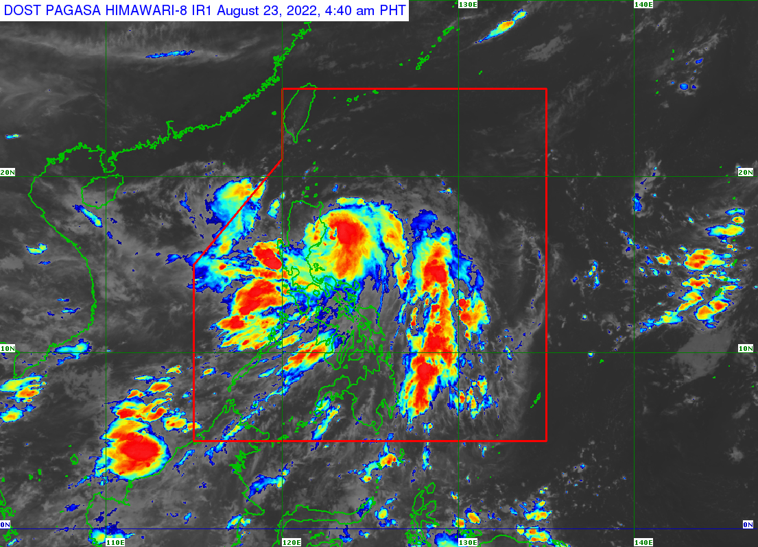
PAGASA handout
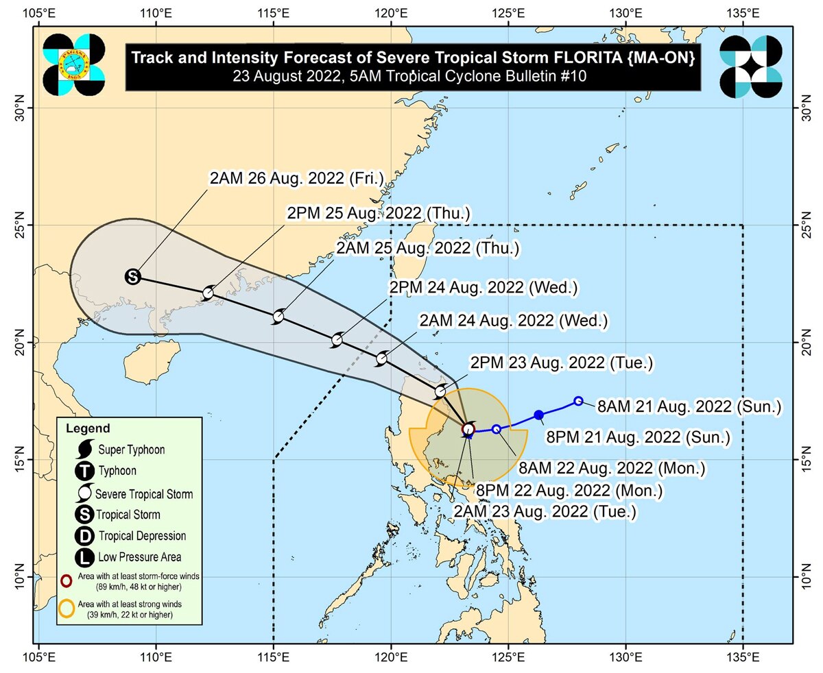
MANILA—Florita has intensified into a severe tropical storm and is heading for the Isabela-Cagayan area, PAGASA said early Tuesday morning.
In its 5 a.m. weather bulletin, PAGASA said Florita was last sighted at 4 a.m. approximately 120 km east northeast of Casiguran, Aurora. The severe tropical storm is packing 95 kph winds and 115 kph gusts, while moving north northwestward at 10 kph.
Florita will make landfall in the vicinity of the east coast of either Cagayan or northern Isabela on Tuesday morning or early afternoon, the weather bureau said.
"Afterwards, the storm will traverse Northern Luzon and emerge over the West Philippine Sea tonight. On the forecast track, Florita may exit the Philippine Area of Responsibility (PAR) on Wednesday morning," it said.
The state weather bureau raised tropical cyclone wind signal no. 3, in the following areas in Cagayan and Isabela due to likelihood of storm-force winds:
Northern and eastern portion of mainland Cagayan (Santa Praxedes, Claveria, Sanchez-Mira, Pamplona, Abulug, Ballesteros, Lal-Lo, Baggao, Peñablanca, Gattaran, Aparri, Camalaniugan, Buguey, Santa Ana, Gonzaga, Santa Teresita)
Eastern portion of Isabela (Maconacon, Divilacan, Palanan)
PAGASA warned residents in the affected areas of "moderate to significant threat to life and property."
Rest of Cagayan including Babuyan Islands, the rest of Isabela, Quirino
Eastern and central portions of Nueva Vizcaya (Kayapa, Ambaguio, Solano, Villaverde, Bagabag, Diadi, Quezon, Bayombong, Bambang, Aritao, Dupax del Sur, Dupax del Norte, Kasibu, Alfonso Castaneda)
Northern and central portions of Aurora (Dilasag, Casiguran, Dinalungan, Dipaculao, Baler, Maria Aurora)
TCWS No. 1 is still in effect in:
Batanes
Rest of Nueva Vizcaya
Rest of Benguet
La Union
Pangasinan
Eastern portion of Tarlac (San Clemente, Camiling, Moncada, San Manuel, Anao, Santa Ignacia, Gerona, Paniqui, Ramos, Pura, Victoria, La Paz, City of Tarlac, Concepcion)
Nueva Ecija
Rest of Aurora
Eastern portion of Pampanga (Magalang, Arayat, Candaba)
Eastern portion of Bulacan (San Ildefonso, San Miguel, Doña Remedios Trinidad, San Rafael, Angat, Norzagaray, City of San Jose del Monte)
Eastern portion of Rizal (Rodriguez, San Mateo, City of Antipolo, Tanay, Baras)
Northern portion of Quezon (General Nakar, Infanta, Real, Mauban, Perez, Alabat, Quezon, Calauag) including Polillo Islands
On Tuesday, Florita will bring heavy to intense with at times torrential rains in Cagayan, Isabela, Cordillera Administrative Region, Ilocos Region, and Zambales, PAGASA said.
ADVERTISEMENT
Moderate to heavy with at times intense rains will also fall in the northern portion of Aurora, Bataan, Tarlac, and the rest of Cagayan Valley.
Residents in Metro Manila, Calabarzon, Camarines Norte, and the rest of Central Luzon will also experience light to moderate with at times heavy rains, the weather agency said.
"Scattered to widespread flooding (including flash floods) and rain-induced landslides are expected especially in areas that are highly or very highly susceptible to these hazard as identified in hazard maps, and in localities with significant antecedent rainfall," PAGASA said.
ABS-CBN is the leading media and entertainment company in the Philippines, offering quality content across TV, radio, digital, and film. Committed to public service and promoting Filipino values, ABS-CBN continues to inspire and connect audiences worldwide.
Our website is made possible by displaying online
advertisements to our visitors. Please consider supporting
us by disabling your ad blocker on our website.
Our website is made possible by displaying online
advertisements to our visitors. Please consider supporting
us by disabling your ad blocker on our website.