Welcome, Kapamilya! We use cookies to improve your browsing experience. Continuing to use this site means you agree to our use of cookies. Tell me more!
Mawar slightly intensifies, may spawn floods, landslides in northern Luzon
Mawar slightly intensifies, may spawn floods, landslides in northern Luzon
ABS-CBN News
Published May 26, 2023 12:07 PM PHT
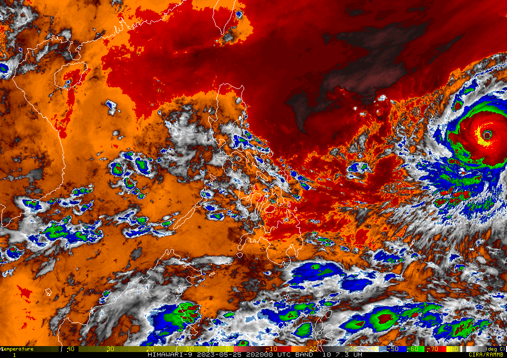
RAMMB/US NOAA/Himawari 8
MANILA — Super typhoon Mawar slightly intensified as it moved over the Philippine Sea on Friday morning, PAGASA said, as it warned of possible floods and landslides in northern Luzon.
Mawar was last spotted 1,705 km east of southeastern Luzon at 10 a.m., packing maximum sustained winds of 215 kilometers per hour near the center and 260 kph gusts, the state weather bureau said.
Moving west at 20 kph, Mawar may enter the Philippine area of responsibility on Friday night or Saturday morning.
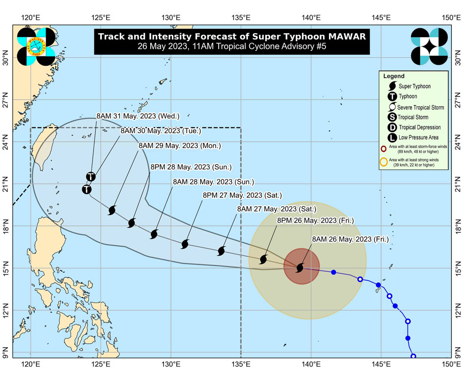
Intensity and track forecast for super typhoon Mawar. PAGASA
It is expected to slow down while approaching Luzon's northern tip and could reach its peak intensity within 24 hours, the weather forecaster said in its 11 a.m. advisory.
ADVERTISEMENT
From late Sunday or Monday, Mawar will bring heavy rains that could trigger flooding or landslides in northern Luzon, PAGASA said.
The agency said it might raise tropical cyclone wind signals on Saturday evening in preparation for strong winds expected in northern Luzon.
ABS-CBN is the leading media and entertainment company in the Philippines, offering quality content across TV, radio, digital, and film. Committed to public service and promoting Filipino values, ABS-CBN continues to inspire and connect audiences worldwide.
Our website is made possible by displaying online
advertisements to our visitors. Please consider supporting
us by disabling your ad blocker on our website.
Our website is made possible by displaying online
advertisements to our visitors. Please consider supporting
us by disabling your ad blocker on our website.